 In February 2022, the City received a letter challenging the City’s current election system and asserting that the City’s at-large election system violates the California Voting Rights Act (CVRA). In light of the letter and to protect the City from financial and legal risks, Santa Paula has taken steps to transition its at-large election process to district-based elections.
In accordance with standard districting practices established by the State of California, the City of Santa Paula is using the 2020 Census data that was released in September 2021 to create City Council voting districts for the first time. As the City undergoes the district formation process, it is seeking input from the public on where the district boundaries should be drawn.
To date, the City of Santa Paula has held two public hearings and three community workshops to give residents an opportunity to learn more about district formation and provide feedback on neighborhoods that should be kept together for the purpose of electing a City Council Member. At each of the public meetings, attendees participated and provided insight into Santa Paula’s neighborhoods and communities of interest. The feedback received at each of the meetings is available on the Schedule page of the City’s districting website.
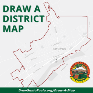
Throughout the remainder of the process, Santa Paula residents are encouraged to draw and submit proposed voting district maps for City Council consideration. Residents are not required to submit complete maps; they can simply draw boundaries for their own desired district or highlight what they consider to be their neighborhood boundaries. Instructions on how to draw and submit a map, including a video tutorial on how to use the online mapping tool, are available on the Draw A Map webpage.
Once draft maps are submitted, they will be reviewed and standardized by the City’s demographer and posted to the Draft Maps webpage with a breakdown of demographics for each proposed district.
The City Council’s first review of draft maps will take place at the public hearing scheduled on January 18, 2023. The deadline to submit maps for consideration at this meeting is January 6, 2023 by 11:59 p.m. All maps submitted by the deadline will be processed by the City’s demographer and posted to the Draft Maps webpage no later than January 11, 2023 with a breakdown of demographics for each proposed district.
Residents will be able to submit maps until February 1, 2023 for consideration at the fourth public hearing. The remainder of the district formation schedule is laid out as follows:
- January 6, 2023 – Deadline for the public to submit maps for the January 18 public hearing
- January 11, 2023 – Draft maps posted on website
- January 18, 2023 – Third public hearing to review first round of draft maps
- January 21, 2023 – Community workshop
- February 1, 2023 – Final deadline for the public to submit maps for consideration
- February 8, 2023 – Draft maps posted on website
- February 15, 2023 – Fourth public hearing to adopt a map
- March 1, 2023 – Second reading of ordinance at the City Council meeting
To learn more about the district formation process and future public participation opportunities, visit DrawSantaPaula.org.